Meeting Reports April 2025
Leader : Bernard Russell
Other Attendees :
Meet : 1.30 pm in lay-by off the A635 East of the A1 junction.
Subject : Seeing a woodland in the early stages of regeneration into a traditional coppice with standards wood.
Present, Bernard Russell leading the walk, 6 Doncaster Nats members.
Weather: Bright , sunny at times.
Mr. Russell gave a background to his purchase of the wood in 2011.
Ducker Holt is over 200 years old having been part of the Brodsworth Hall estate. It extends to 3.27 hectares, with an adjoining small plantation dating from the construction of the A1m in late 1950s. The plantation remains in Highways England ownership.
The wood is covered by a tree preservation order, so to facilitate management, a woodland management plan was prepared and felling licence granted. A second plan and licence has been approved in April this year, covering the years 2025 to 2035.
A system of coppice with standards has been adopted. Thinning of standard trees will be mainly by reducing sycamore which has been increasingly invasive.
Oak , beech and ash (disease permitting) will form a major part of the canopy.
There are however 19 different genera of trees. Introductions have been limited, Tilia cordata being one exception
Hazel with be the main coppice species.
Biodiversity is the main aim of the woodland management plan.
Wood Anemone, Celandine, and to a lesser extent Bluebell, are the most conspicuous ground flora species. Increased light levels will hopefully enhance this layer.
Goldilocks (Ranunculus auricomis) was identified on the walkabout. An indicator of old, if not ancient woodland. Ducker Holt obviously not in the latter category.
A glade has been formed in the wood, this is cut and raked off after flowering in late summer. A few introductions have been made in this area, birds foot trefoil has established, yellow rattle to reduce the vigorous grasses , not so successful.
Galls on oak was given attention by members , particularly new season growth.
A management aim is to increase deadwood communities. Standing wood – ringbarked sycamores, retained dead elms, and several habitat piles have been created.
The visit was very much appreciated by Mr. Russell, and further possible activities could include:-
Moth recording,
Beetle survey,
Autumn fungal survey,
Archaeology – there are extensive limestone deposits on the edge of the wood, these have been ploughed out from the adjoining field , and tipped over many years.
Bernard Russell, 24 April 2025
Leader : John Scott
Other Attendees :
Meet : 1.30 pm on site (SE605134)
Subject : Admiring the display of spring flowers
Leader : Mick Townsend.
Other Attendees :
Meet : 7:30 pm at the level crossing on Applehurst lane. (SK539912)
Subject : A Newt discovery and census meeting Wood Anemones and Moonwort search.
Leader : Colin Howes
Other Attendees : nil unfortunately.
Meet :
Subject : Photographing and/or admiring (Pip’s) Owston Fritillaries
It was a lovely morning at Owston Meadows, and I apologise for not giving people sufficient time to respond to the call for an ad-hock field meeting.
With the hedgerow along Stockbridge Lane still in the process of greening up, it was quite possible to see the colourful patch of flowers through gaps in the greenery, probably making them quite vulnerable to passers-by wishing to pick them.
The colony looked wonderful, nodding and bobbing in the breeze and were most photogenic (though I didn’t have a camera!). I’m sure they’ll be in flower for a few weeks yet, if DNS members wish to arrange with Margaret to take photos.
The flower heads were so closely packed together, there was a definite problem in making a reliable count. However, by dividing the patch up into sections by laying tall Phragmites reed stems across the colony, I came up with the following count:
Purple/Chequered heads = 90
Cream/White heads = 18
Immature non-flowering plants = c.46
Decapitated plants = 2
Total Fritillaries = c.156
At least there weren’t any Lily Beetles Lilioceris decapitating the colony as regularly happens in domestic gardens, but a single Carder Bee Bombus pascuorum was collecting pollen and hopefully fertilizing the flowers.
I suppose a later visit to count the number of seed-heads would be a useful exercise.
On the way back to Margaret and Jeff’s house to return the key I wandered through the churchyard of the 12th Century All Saints Church and found the place deserted, even on Palm Sunday. I know the congregation now use the sister churches in Carcroft and Skellow but my recollections are of Rev. Marc Seccombe, Pip Seccombe and their family being based in the vicarage and the place being a hive of activity … bless you Marc and Pip, you are greatly missed but the Fritillaries and the Owston Hay Meadows Nature Reserve are legacies we greatly enjoy.
CAH.
Leaders : Joyce & Paul Simmons and Louise Hill.
Other Attendees :
Meet : 10.30 am in Brockadale car park WF8 3JS (SE512174).
Subject : Wood Anemones and Moonwort search.
Leaders : Louise Hill & Colin Howes
Other Attendees : Tim, Jim, Les, Lesley
Meet : 1:30 pm at Clifton Beacon. SK519962 Postcode S66 7SA
Subject : The proposed Solar Farm:
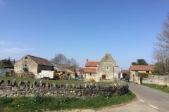
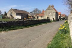
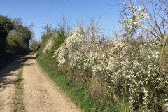
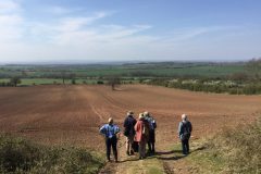
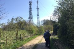
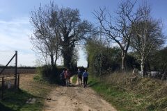
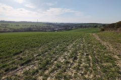
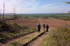
Introduction: On a dazzlingly bright sunny day, six DNS members met at 1.30pm at the bus shelter on Beacon Lane, Clifton SK519962 Postcode S66 7SA. We proceeded west along the un-metaled, thickly hedged section of Beacon Lane (photos 3 & 5 above) to the left hand dog-leg (SK517 961). Here, at the field entrance and at the edge of the Permian Magnesian Limestone ridge, we were able to look due west out over the entire landscape of Conisbrough Parks and to the Pennine hills in the far distance. This must be one of the most spectacular outlooks in the Doncaster region. Using the print-out of the Whitestone Solar Farm Masterplan map we were able to pick out the fields proposed for solar panels and those proposed for landscape mitigation.
Louise & Tim, who had walked in from the adjacent village of Micklebring, south of the M18, elected to keep walking the network of Conisbrough Parks public footpaths and do a circuit of the site before returning to Micklebring. The rest of us took the short walk south along the limestone ridge past Clifton Beacon Radio masts at an altitude of *144 metres (472 feet) and on to the steep west-facing grassland (highlighted as a Nature Reserve on some maps) now heavily colonised by Hawthorns, Willows, and Cotoneaster shrubs and down to the excavated pond at the bottom of the field (SK517 956). This constituted a short stroll with a round trip of just over 1 mile.
Notes from Field notebook entries –
Invertebrates: The bright spring sunshine had brought out several queen bumblebees including the red-tailed Bombus pratorum and Bombus lapidarius and the white-tailed Bombus terrestris. Prospecting exposures of carboniferous clay was the Tawny Mining Bee Andrena fulva.
Butterflies on the wing were Speckled Wood (in woodland along the ridge), Small Tortoiseshell, Peacock, Small White along the nettle-rich hedgerows and grassland by the lane. 7-Spot Ladybird Coccinella septempunctata. Various Drone flies including Eristalis tenax were out of hibernation and a Bee fly Bombylius major was prospecting for hymenopteran breeding holes in which to deposit its eggs.
Vegetation: In the hedgerows – (Trees & Shrubs) Ash Fraxinus excelsior, Hawthorn Crataegus monogyna, Elder Sambucus nigra, Blackthorn Prunus spinose, Dogwood Cornus sanguinea, Dog Rose Rosa canina, Honeysuckle Lonicera periclymenium, Ivy Hedera helix.
(Herbage) Dog’s Mercury Mercurialis perennis, Wild Arum Arum maculatum, Lesser Celandine Ficaria verna.
(Ruderals) Cow Parsley, Hogweed, Common Nettle, Garlic Mustard Alliatia petiolate, Lesser Burdock Arctium minus, Broad Dock Rumex obtusifolius, Common Mallow Malva sylvestris, Prickly Sow-thistle Sonchus asper, Creeping Thistle Cirsium arvense, Spear Thistle Cirsium vulgare, Red Deadnettle Lamium purpureum, White Deadnettle Lamium album, Hoary Cress Lepidium draba, Germander Speedwell Veronica chamaedrys, Common Field Speedwell Veronica persica, Ground Ivy Glechoma hederacea, Clevers Galium aparine, Shepherd’s Purse Capsella bursa-pastoris, Groundsel Senecio vulgaris, Chickweed Stellaria media.
Birds: Demonstrating the changes of the seasons, Louise noted a flock of 20+ Fieldfares representing the last of the winter migrants, while Les noted, what was his first summer sighting of Swallows (over Clifton Village) and on the approach to the village when arriving, also Chiffchaffs (in the ridge woodland) representing incoming summer migrants.
Other birds noted [S = singing, thus holding territory] were Song Thrush (S), Blackbird (S), Robin (S), Wren (S), Chaffinch (S), Bluetit (S), Great Tit (S), Pheasant calling, Starling, Magpie, Carrion Crow, 4 Linnet & Greenfinch (in the steep grassy field), Wood Pigeon, Feral Pigeon, Collared Dove (in Clifton village), Moorhen (by the pond), Sparrowhawk, sitting on a fence by the play area, before flying off, & Common Buzzard.
Molluscs associated with the limestone slabs cast to the edged of arable fields along Beacon Lane were White-lipped Snail Cepaea hortensis, Common Garden Snail Cornu aspersum (formerly Helix aspersa) and Kentish Garden Snail Monacha cantiana.
Steep Grassy Field (SK5195 possibly a nature reserve) – Cowslip Primula veris, Tor Grass Brachypodium pinnatum, Crested Dog-tail Cynosurus cristatus, Hard Rush Carex inflexus, Colt’s foot Tussilago farfara, Daisy Bellis perennis, Common Ragwort Jacobaea vulgaris, Yarrow Achillea millefolium, Hawthorn Crataegus monogyna, Goat Willow Salix caprea, Cotoneaster sp.
Rosette Galls on a Goat Willow indicated the presence of the Cecidomyiid Fly Rhabdophaga rosaria.
Mammal species included Mole (many mole hills), Rabbit, Stoat and Fox (scent).
A possible reason for the invasion of even-age shrub development could be due a synchronous but temporary removal some years ago of the rabbit population by disease (possibly by Myxomatosis or some hemorrhagic pathogen). It could also have been due to the removal of grazing livestock such as cattle or sheep.
Pond – Reedmace Typha latifolia, a Broad-leaved Potamogeton sp. and a grey sedge possibly Carnation Sedge Carex panacea.
Social History:
On looking across to Micklebring, Les reminisced that in his youth he had been a keen club cyclist and after 10 mile time trials out to Tickhill the club used to gather for refreshment at the Plough, Micklebring. Jim, referring to the origins of the the place name, Micklebring, quoted an old saying, “many a mickles makes a muckle”.1
Another aspect of social history relating to Micklebring can be found at :
https://www.tickhillhistorysociety.org.uk/the-ruddle-pit
Correction and apologia:
- Please ignore the altitude of 46 metres as noted on the advert for this outing (so much for pulling data from the internet without the necessary fact checks). https://www.cucaera.co.uk/grp/ gives a more realistic altitude of 144m (472feet) for SK5190 9588. Curiously, this is the same height as for the Trig Point on Fordoles Head Lane overlooking the M18 near Maltby which is universally (but perhaps erroneously) quoted as the highest point in the Doncaster Met Borough.
- Also there ought to be an OS Triangulation point at Clifton Beacon. Perhaps we should campaign for one to be developed as a public outlook.
- And why isn’t there a weather station up here?
CAH.
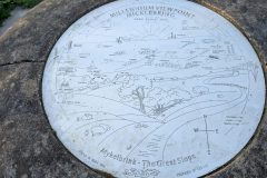
Our walk commenced from a small car park in Micklebring with view-finder and plaque commemorating the successful CRUSADE campaign to stop opencast mining of the Conisbrough Park area. The view finder, designed by Sprotbrough artist Sheila Bury in 2000, explains that the village name ‘Mykelbrink’ means ‘The Great Slope’. Undulations in the sheep-grazed field in the foreground are the remains of historic bell pits dug to extract the red ‘ruddle’ pigment.
Our route took us down from the village to an underpass beneath the M18 and up the hill to Clifton Beacon. On our way we passed freshly opened flowers of Primrose Primula vulgaris, and the shiny whorls of leaves of a hedge bedstraw Galium album in a field on the southern side of the underpass. There were also scattered clumps of cowslip Primula veris growing on the verge of the busy M18. Cowslips were also plentiful beside the footpath as it climbed up through the rough grassland to the Beacon.
We had lunch overlooking the panoramic viewpoint just below the escarpment on the corner of Beacon Lane, observing a bin lorry leaving Parks Farm Cottages creating a huge a cloud of white dust on the dirt track, a pair of Peacock butterflies in mating flight and a stoat bounding along the field margin. We rendezvoused with the main party and, after a short discussion on the significance of this location (being the transition between the Magnesian Limestone and Coal Measures), we set off north to attempt a loop walk around Conisbrough Parks. The first few yards of the wooded footpath had a collection of limestone woodland herbs including common dog and early dog violets Viola riviniana and V. reichenbachiana) before we descended through horse fields on the footpath towards Parks Farm. A notable veteran coppiced specimen of field maple Acer campestre grows beside a small stream at the edge of the paddocks.
At Parks Farm the path takes a dog-log back across closely grazed sheep paddock to the disused railway and follows a lane past Clifton Gorse, appropriately clothed in the golden-flowered common gorse Ulex europaeus that gives that site its name. A glance to the south, beyond a gated continuation of the lane, indicated the presence of a new pond, possibly supporting the giant kingcup Caltha palustris subsp polypetala.
Our route continued to Conisbrough on the roads, crossing above Ashfield Brick Pit Geological SSSI in Conisbrough and descending to Kearsley Brook via the ‘terra nova’ of Pigotts Park, where we saw our first orange tip butterfly and red-tailed bumblebee of the Spring. Climbing up some improbably steep and glass-strewn steps to the top of Holywell Hill we then traversed along a dilapidated alleyway alongside the cricket Ground to emerge back on the pavement alongside the noisy and dusty Sheffield Road in order to reach our target of Park Lane. This lane has a hedge only on the western side. Blackthorn Prunus spinosa dominates with some limestone herbs such as wild arum Arum maculatum, dog’s mercury Mercurialis perennis and one or two plants of crosswort, but also an abundance of nitrophilous herbs including nettle Urtica dioica and cleaver Galium aparine.
Our route south-west across to Firsby left Park Lane just after the private side lane to Parks Farm Cottages and crossed over several rather bleak arable fields on a rough and cracked dry earth footpath before we reached a small brook that runs down to Frisby Hall Farm. The steep tree-lined western bank of the almost dry brook supported the only native flora for some distance, including bluebell Hyacinthoides non-scripta, wild angelica Angelica sylvestris and meadow sweet Filipendula ulmaria.
On reaching Firsby Reservoir, once part of the Doncaster Borough but now a local Nature Reserve managed by Rotherham MBC, we took an anticlockwise loop around the drained eastern reservoir past a small plant of western sword fern (Polystichum munitum) noted by Tim during a visit to the site a few weeks previously. We paused for a refreshing drink in the hot(!) spring sunshine on a metal bench (also with a plaque to commemorate the CRUSADE campaign) before heading east along the footpath towards Micklebring. This path follows a steep earth bank with abundant blackthorn and gorse, with unexpected damp sections supporting abundant meadowsweet, before leaving all traces of field boundaries behind to cross over exposed cereal fields towards the bridge over the disused railway. Passing a small wild cherry Prunus avium in full flower at the head of ‘The Brook’ we returned to the M18 underpass to climb the footpath back up to Greaves Sike Lane and our starting point and thence to Whitby’s for a well-earned fish supper.
Total distance Approx. 14km
Louise Hill & Tim Prosser
Note : –
In the book “Geology of Yorkshire” by Kendall & Wroot (1924), p. 242
…It was the work of Hutton and Playfair already referred to, and later of the splendid observation and thought of Sir Charles Lyell (1797-1875), to teach the geologist the truth of the proverb that “Mony mickles mak’ a muckle.”
